
Middleborough Street Directory Address Trail
Use the Middleborough street directory as a chain, not as a single list of everyone on a road. The Middleborough assessor and Middleborough MapGeo help identify the parcel tied to a street number. The Plymouth County Registry of Deeds then supplies the legal document trail. Middleborough Town records and historical collections can add a dated household clue, but an assessed owner, mailing address, and occupant are different things. Middleborough address work is strongest when the same street spelling, parcel reference, and time period appear in more than one source.
Start with the physical address, not an assumed name. A situs address marks the Middleborough place on the ground. A mailing address marks where tax correspondence goes. The distinction matters in Middleborough because a mailing address can be elsewhere or can belong to a trust, business, or agent. The map and deed are useful even when they do not identify a full household.
- Search the address in Middleborough MapGeo, select the parcel, and record its Property ID or map position along with the street spelling.
- Compare the parcel with the Middleborough assessor route for the assessed owner, situs, mailing address, and property-card details that are available.
- Use the owner and street clues in TitleView, narrowing to Middleborough and a sensible document date when a deed or plan is the next record needed.
- For a dated local name, ask the Middleborough Town Clerk about lawful access to a local street-list or election file. The individual state status form is not a street roster.
- For an older address, compare directory years, Gazette material, Sanborn maps, and the library's renumbering files before drawing a household conclusion.
Middleborough Addresses in MapGeo
Middleborough MapGeo is the map-first route for a street search. Its visible Attributes panel accepts address, owner, and Property ID text. Quick Search, map selection, Themes, Markup, and Abutters give other ways to move through a Middleborough street segment. Selecting an adjacent parcel can be more useful than repeatedly retyping a long street name. The map supplies parcel context, while the assessor and Registry remain the verification layer for title and exact legal records.
| Middleborough MapGeo control | Type | Street-use note |
|---|---|---|
| Address | Text | Find a Middleborough street or numbered address in the Attributes search. |
| Owner | Text | Compare an assessor owner clue with the mapped Middleborough parcel. |
| Property ID | Text | Return to a specific Middleborough parcel after recording its identifier. |
| Selection | Map tool | Choose a Middleborough parcel directly from the map. |
| Abutters | Tab/tool | Review adjoining Middleborough parcel context without claiming a complete household list. |
| Themes | Tab | See Middleborough map and land-use context; the visible layer set can change. |
MapGeo says its data is approximate, may use third-party sources, has no legal effect, and is not a survey. Treat a Middleborough map label as a starting point, then confirm a Middleborough title question in the Registry image or at the assessor counter.
The MapGeo property viewer shows the address, owner, and Property ID entry points used for a Middleborough street directory search.
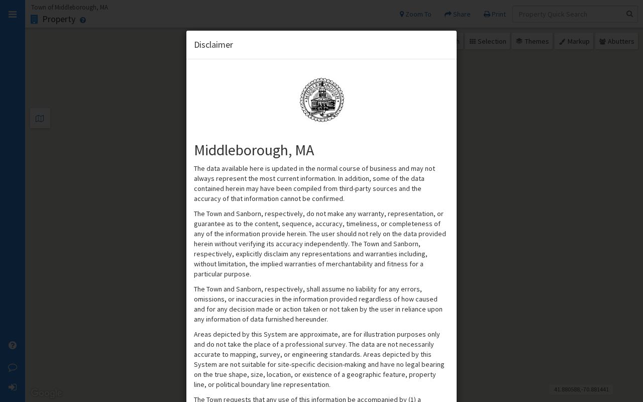
Those Middleborough fields make it practical to anchor a road name to a particular Middleborough parcel before following the deed record.
Middleborough Street Directory Parcel Checks
The Middleborough Board of Assessors property portal advertises owner information and property record cards for each parcel. The live Middleborough interface supports owner-name, address, and parcel routes, although the static inspection did not expose every dynamic field label. Use the result to compare the assessor owner, mailing address, situs address, map or lot reference, assessed values, exemptions, sketch, acreage, or characteristics that appear on the card. Do not substitute it for a deed. The Middleborough assessor itself directs deed and subdivision-plan questions to the Registry.
A parcel is a defined piece of land used for assessment and mapping. A situs address is the physical address assigned to that parcel. A plat or plan is a recorded drawing that can show lots, boundaries, and road layout. These terms help a Middleborough search stay on the same piece of land even when a street number or road label changes.
- Parcel
- A Middleborough mapped assessment unit, which may be a lot, building site, or other piece of land.
- Situs address
- The physical Middleborough place where the parcel sits, rather than the address used for tax mail.
- Map or lot reference
- A local Middleborough map-based land reference that can connect a property card, plan, and deed.
- Criss-cross directory
- A directory arranged to help move from a Middleborough address to the name recorded for that location in a particular year.
Middleborough Street Names and Numbers
Middleborough address history has several built-in traps. The western part of the town became Lakeville in 1853, so an older directory or postal reference can pair Middleboro and Lakeville even when the modern parcel lies on one side of the present boundary. Historical material also uses Centre Avenue for what later records call Centre Street. Preserve both versions in notes and search both when a name seems to disappear.
Address changes also matter inside Middleborough. Annual-report material records E911-related number changes on parts of Brookside Drive, East Grove Street, Ida's Way, Pine Street, Plympton Street, Vine Street, and Wareham Street in 2009. Earlier material identifies changes on Cherry, Crowell, and Wilbur streets. The current address-assignment code took effect in 2018. These facts do not establish a single townwide renumbering event, but they explain why an old directory address may need a map, plan, or legal description to reconnect with a modern parcel.
Note: Keep the old street spelling beside the current address when comparing a Middleborough deed, map, directory, or Gazette notice.
Middleborough Street Directory Record Coverage
Address-keyed records do not carry the same weight. The Middleborough assessor route and MapGeo identify a parcel. The Middleborough Registry route is the legal transfer source. Middleborough permits and maps add a dated project or land-use clue. Town election and census material has separate rules and protected categories. The table keeps each Middleborough source in its proper role rather than treating a street name as proof of every person connected with a property.
| Middleborough address record | Keeper | What it can show | Access route |
|---|---|---|---|
| Parcel card | Middleborough Assessors | Assessed owner, mailing and situs address, map/lot, value, exemptions, and card details. | Vision portal or Middleborough assessor counter. |
| Parcel map | Middleborough MapGeo | Address, owner, Property ID, parcel geometry, themes, and adjoining parcels. | Public viewer; approximate and non-legal. |
| Recorded land | Plymouth Registry | Grantor, grantee, document date, book/page, plan reference, and Middleborough legal description. | TitleView search and view, older books or stations in Plymouth. |
| Permit or code record | Middleborough departments | Address, project, inspection or sign-off, and named applicant where public. | Permit view or a focused records request. |
| Street-list material | Middleborough Town Clerk | Defined public fields in a lawful local file, subject to confidentiality limits. | Ask the local election official for the relevant version. |
| Historic directory and Gazette | Middleborough Silvia Genealogy Room | Dated occupant, business, notice, obituary, or organization clues. | Library research and digitized newspaper access. |
Middleborough map or lot information can tie the assessor card to a recorded plan. A TitleView deed can add the prior reference that connects earlier ownership. That chain is more reliable than matching a common surname to a street on its own.
Middleborough Street Deeds in TitleView
Plymouth County TitleView is the recorded-land path for a Middleborough address. Search and viewing are free. Its Recorded Land routes include name, book, date range, document, and property searches, and Advanced Search can narrow a Town and Document Type. A selected result opens in a detail tab, and View Images opens the recorded pages. Pop-up blocking can prevent that viewer from working. Printing and downloads use a subscription and per-page arrangement, while certified copies use the Registry request channels.
| TitleView control | Use for a Middleborough street search |
|---|---|
| Recorded Land | Choose the main Middleborough recorded-deed and document route. |
| Name Search | Search a Middleborough owner, seller, trust, estate, or other indexed party. |
| Property Search | Use the Middleborough address-related route when its available result supports the parcel trail. |
| Book Search | Search Books 2393-current, Books 1-2392, or the historical book collections as appropriate. |
| Date Range and Town | Narrow a document period and choose Middleborough when that filter is available. |
| Document Type | Refine an advanced search without assuming a complete published option list. |
| Plans | Search plan material by name, book, date, plan number, or property route. |
Older records need a different expectation. Plymouth books reach Book 1 in 1686, but linked searching is strongest from 1945 for grantor records and 1955 for grantee records. Pre-1970 grantor and pre-1960 grantee indexes are unedited. When a Middleborough name search fails, use fewer characters, test spelling variants, and consult the printed indexes or original books at the Registry's public-access stations.
Middleborough Street History Files
For an older Middleborough street, the Silvia Genealogy Room supplies a paper-to-map bridge. Its local-history materials include an early-1900s downtown Street, Business and Resident Directory, the 1946 Middleboro telephone directory, the 1940 WPA Historic Buildings Catalog, cemetery-history material, and Middleboro Street Renumbering lists. The Gazette index covers 1852-1868 and 1905-1982, while the digital newspaper archive reaches Middleboro Gazette years from 1857 to 1930. These are dated snapshots, not a modern street roster.
Search the address in the closest directory years, then pair a result with a census year, Gazette notice, map, or deed. A directory line may include boarding or home notation, a business, or an associated address. The historical volumes are described in more detail in the Middleborough City Directories collection, while this street route uses them to test address continuity.
Middleborough's record history reaches earlier than the present town map. Registry books begin in 1686, and Plymouth Colony deed images for 1620-1685 have indexes at the end of each book. The local library's historic-building catalog and renumbering file make it possible to connect that long land record to a twentieth-century address without pretending that every street label stayed fixed.
Middleborough Street Directory Fraud Alerts
The Registry's free Property Fraud Alert can notify a subscriber when a document is recorded under a subscribed name. It is a useful notice tool for a Middleborough owner who wants to review a recorded filing quickly. It is not proof that fraud occurred, and it does not replace checking the document image, parcel history, or a certified copy when one is needed.
The Registry's alert information describes the name-based notice service available alongside Middleborough deed research.
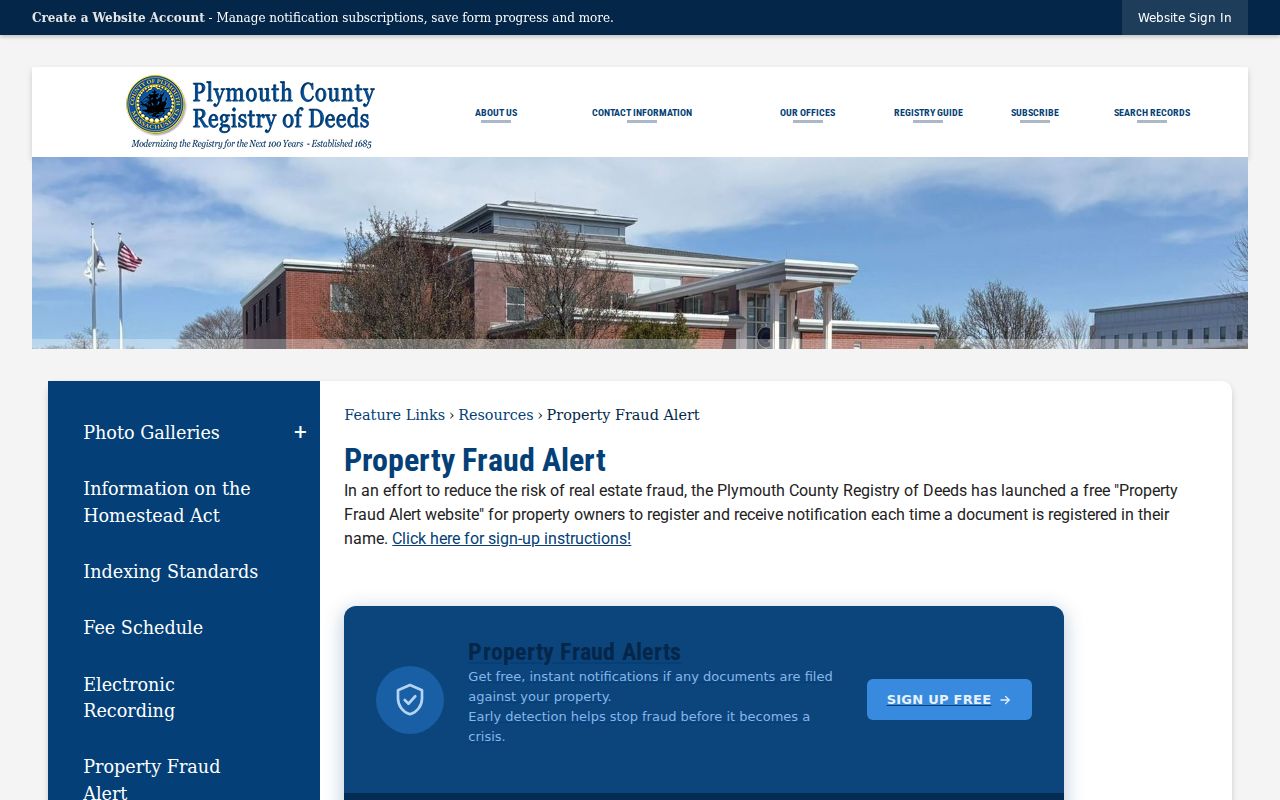
Any alert should lead back to the indexed document, its book or document number, and the recorded image before a Middleborough property history is updated.
Middleborough Street Directory Limits
A Middleborough assessor result identifies the assessed owner and mailing contact, not every person at the situs. A person may own a different parcel, receive mail elsewhere, or appear through a trust or other entity. The state individual voter-status form requires a person's own identifying entries and cannot be used as a public street-list export. A municipal file, when lawfully available, also excludes confidential voters and protected fields.
DMV address records are restricted under the federal DPPA. Utility-customer and delivery records are not public household directories. A permit may identify a responsible applicant or owner, but no public permit result does not prove that no work happened. Middleborough street research therefore needs dated, source-by-source conclusions rather than a claim that one address tool shows every resident.
Middleborough By-Address Research Care
Use Middleborough records for family history, property history, estate questions, civic research, and personal curiosity. Keep notes on the date of each source and verify a land-title question with the Registry or other record custodian. Respect the limits that protect confidential voters and other restricted records.
Lawful use. Middleborough address records support personal, lawful research. Do not use information from them to stalk, harass, intimidate, or harm another person.